
About
SAIRS — Smart Aerial Solutions is a Miami-based visual solutions and technical inspection company delivering comprehensive imaging from the sky and the ground. From telecom tower and powerline inspections to professional real estate photography, aerial video production, Matterport 3D scanning, and ground-level cinematic content, we cover every angle, every project, across South Florida and statewide.
We believe in a hands-on approach. Every project is managed from start to finish by our own specialists
No outsourcing, no delays, no generic deliverables. Just precise, tailored work that meets the highest industry standards.
All final deliverables guaranteed in under 24 hours after capture.
Meet Our founder
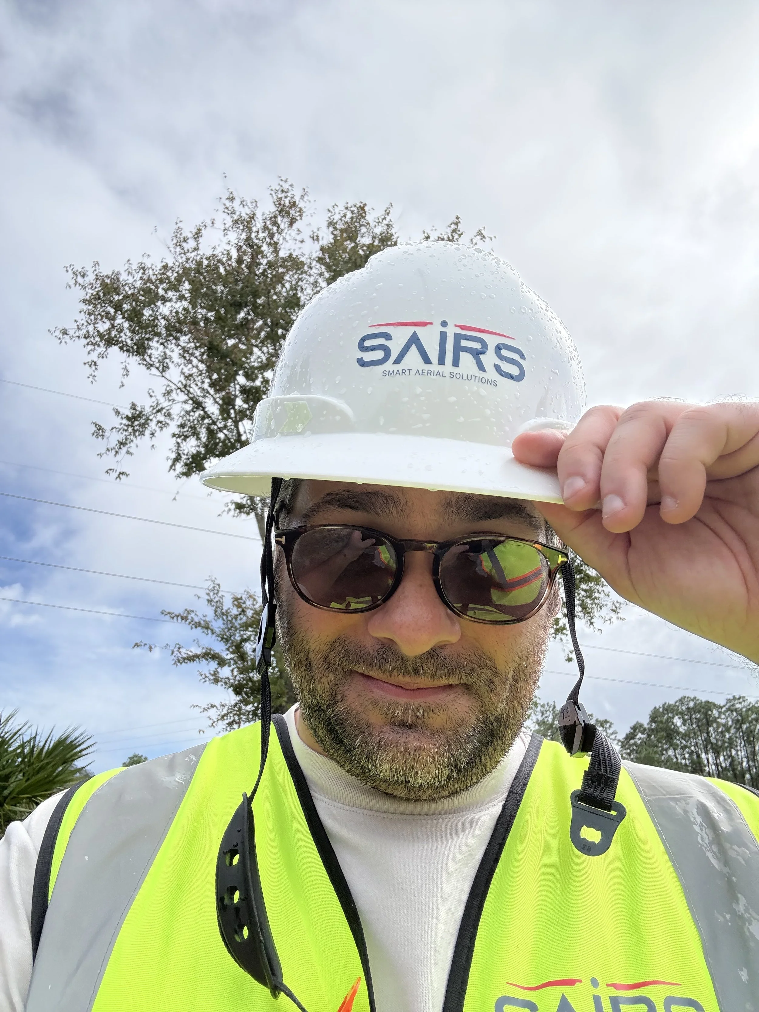
Sebastian — Founder & FAA Part 107 Certified Pilot
I didn't start SAIRS to build a company. I started it because I saw a gap — clients needed more than a service provider. They needed someone who understood the full picture, from the technical demands of a critical inspection to the visual precision of a creative production.
That vision became SAIRS. Today, our team brings together certified pilots, visual specialists, and technical experts — all operating under the same standard I set from day one. Every project is personal, every deliverable is deliberate.
Our Equipment
-
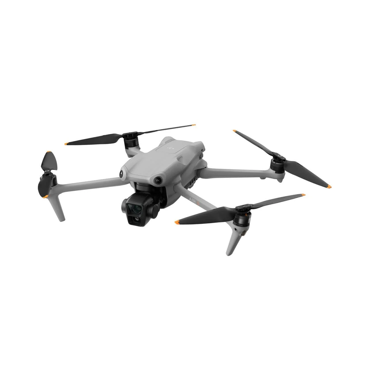
DJI Air 3
Our go-to for creative visual production. Compact, versatile, and built for stunning imagery in any condition.
Dual-camera system with 1-inch CMOS sensor
Forward-facing LiDAR for advanced obstacle sensing
14-stop dynamic range for complex lighting
Used for: Aerial photography, videography, real estate, and commercial content.
-
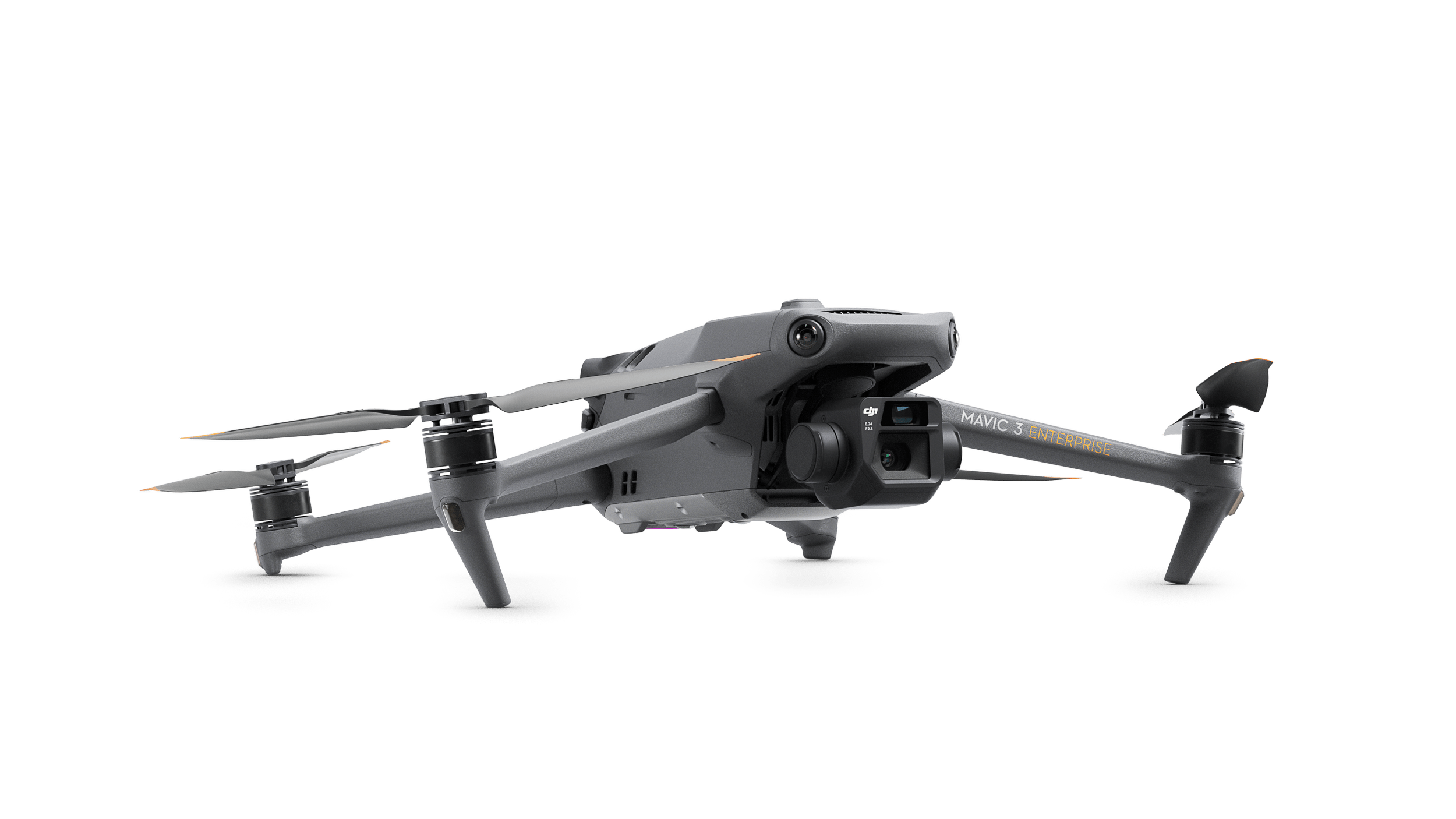
Mavic 3 Enterprise RTK
Our precision mapping and surveying drone. Centimeter-level accuracy for data-grade deliverables.
RTK module for centimeter-level positioning
Mechanical shutter for distortion-free mapping
4/3 CMOS sensor for exceptional image quality
Used for: Mapping, photogrammetry, land surveying, and roof inspections.
-
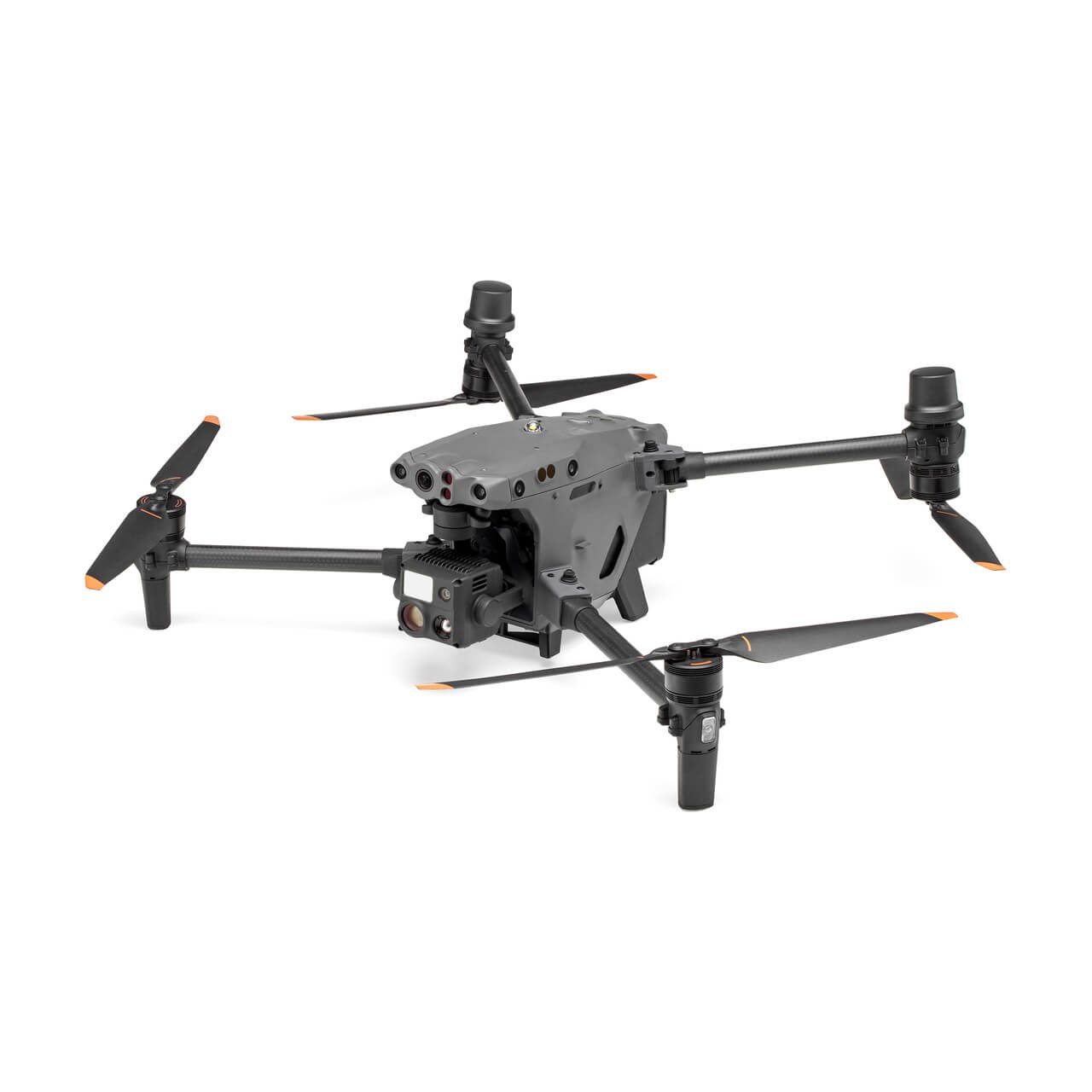
Matrice 30T
Our heavy-duty inspection platform. Built for demanding environments where precision is non-negotiable.
Integrated thermal + zoom + wide camera system
IP55 weather resistance for all-condition operations
16x optical zoom for detailed remote assessment
Used for: Thermal inspections, powerline surveys, and solar farm analysis.
-
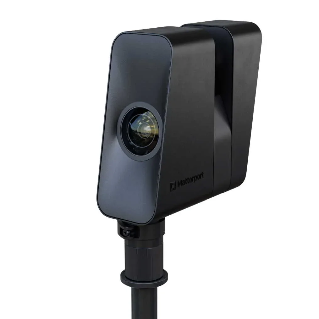
Matterport Pro 3
Our 3D scanning system. The fastest and most accurate way to digitize any space.
LiDAR precision that performs in direct sunlight
Rapid full-scan capture in seconds
High-resolution optics for sharp, detailed walkthroughs
Used for: 3D virtual tours, real estate listings, facility documentation, and remote inspections.
-
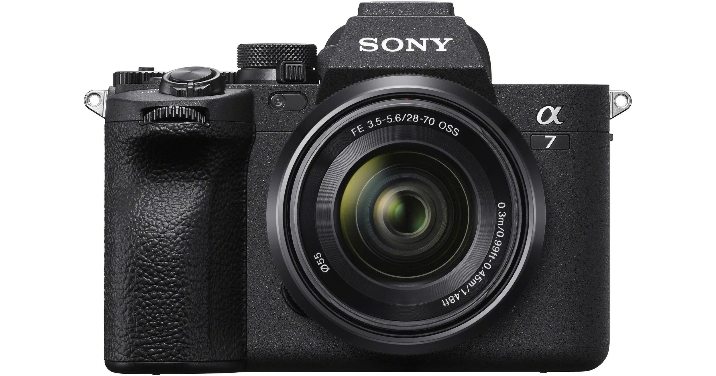
Sony A7 V + Sony FE PZ 16-35mm f/4 G + DJI RS 5
Our ground-level cinematic platform. Built for premium real estate and hospitality content at eye level.
Full-frame 33 MP sensor for exceptional detail · Sony FE PZ 16-35mm f/4 G for smooth cinematic coverage
DJI RS 5 gimbal for fluid motion control
Used for: Real estate photography, hotel and hospitality content, ground-level cinematic video — SAIRS Axis.